By Alexandra Petrulevich
researcher at Dept. of Scandinavian Languages, Uppsala University
Contact: alexandra.petrulevich@nordiska.uu.se; @petrulevich
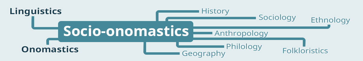
Tags/keywords: East Norse; Norse World; digital humanities; place names; place-name lemma; place-name variant; gazetteer; historical socio-onomastics; historical socio-linguistics; genre; interactive GIS; philology
The Norse World platform
Now as the quarantine restrictions due to COVID-19 pandemic has changed everyday routines for most of us, the professional and cultural live has mostly moved online (for those of us who actually can work at home!). We are encouraged to work at home and stay at home instead of going out, visiting concerts or museums; luckily, we still can explore digital collections of the GLAM (galleries, libraries, archives, and museums) sector and visit concerts at the world’s most renowned theatres. As for the professional part of it, it is for an academic a blessing to have access to primary and secondary material in digital format. For a socio-onomastician stuck in a sofa thinking about their new project, I would definitely recommend having a look at the Norse World platform, an interactive spatial-temporal resource for research on spatiality and worldviews in medieval literature from Sweden and Denmark:
https://www.uu.se/en/research/infrastructure/norseworld/
https://norseworld.nordiska.uu.se/
Project with a spatial perspective
The Norse World project (IN16-0093:1; funded by the Swedish Foundation for Humanities and Social Sciences, Riksbankens Jubileumsfond, 2017–2020) has taken a spatial perspective on the medieval literary corpus from Eastern Scandinavia as its point of departure. East Norse (that is Old Swedish and Old Danish) medieval literature is seen as a mine of information on how foreign space was perceived in the Middle Ages: What places were written about and where? Are some places more popular in certain text types or at certain times? How do place names link different texts? Until very recently, there was no way of answering these potential research questions, because available editions of East Norse texts rarely include basic place-name indices. In other words, the digital Norse World resource first released in 2018 does not repackage pre-existing material. On the contrary, the Norse World infrastructure and its interactive interface is completely new and the first of its kind.
Project data
So, what is the data? The material included is a large database of geocoded attestations of foreign place names and other types of spatial references (that is people or objects or any other phenomena that can be attributed to a geographical location based on its linguistic form) from medieval East Norse texts. The scope of the project is thus unique, since most of the comparable resources (for instance, the Icelandic Saga Map) focus on place names exclusively. Old Danish Paris (Paris) and Old Swedish Ryzland (Russia) are prototypical examples of names in the corpus. Other data types include inhabitant designations, for instance Old Swedish fris ‘Frisian’; origin designations, for example Old Danish lejdisk ‘type of cloth from Leiden’; adjectives, for example Old Danish thythisk ‘German’; language designations such as Latin as well as folk etymologies of bynames, and other appellatives that contain geographical information, for instance Sunamitis ‘of Sunam’. A typical attestation in the Norse World database will include a phrase that the data item is a part of, for instance Old Swedish til egyptum ‘to Egypt’. At the time of writing, the Norse World platform comprises about 5 000 attestation of spatial references. The work on the resource is still ongoing.
Norse World socio-onomastics
How does Norse World do socio-onomastics then? The platform has several, quite advanced filtering options; you can filter the material by genre, language, source (for instance, a particular manuscript you are interested in), work (that is the text the attestation appears in), type of name, level of certainty etc. By using Norse World’s interactive component, you can do a basic map overlay to compare spatial references in different texts, manuscripts or genres. Furthermore, you can download your filtered dataset as a comma-separated file for further offline analysis. In other words, you have many possibilities to compare actual language use across a medieval literary corpus. One of the findings of the project is that spatial information is conveyed differently in texts belonging to different genres. I have compared spatial profiles in two Old Swedish texts, Erikskrönikan (Chronicle of Duke Erik; 1320–1330) and Själens tröst (Consolation of the Soul; 1420–1442). Apparently, the chronicle mostly uses inhabitant designations that constitute about 60 % of the spatial dataset thus prioritising agency and animate actors. On the contrary, the major source of spatial information in Consolation of the Soul is places (80 % of the entire dataset). These results come from a tiny fraction of the corpus, a comparison of two manuscript versions of two medieval texts, but there is so much more to explore. Have a look!
Further reading
Petrulevich, Alexandra, Agnieszka Backman, and Jonathan Adams. “Medieval Macrospace Through GIS: The Norse World Project Approach.” The Cartographic Journal, September 25, 2019, 1–10. https://doi.org/10.1080/00087041.2019.1596341.
Petrulevich, Alexandra (2020, in press). Med ortnamnsvarianten i centrum: presentation av ett teoretiskt och metodologiskt verktyg för att analysera namn i skrift. In: Meijerbergs arkiv för svensk ordforskning.
Petrulevich, Alexandra (forthcoming). The multi-layered spatiality of the Global North: Spatial references and spatial constructions in the medieval East Norse literature.